


 다운로드 TOP50
 PC 카테고리
 자유게시판
자유게시판
AOS
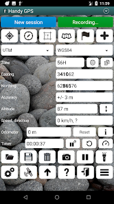
지도/내비게이션
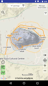
Australian Geology Travel Maps
Australian Geology Travel Maps is a field app that displays the best available data from the government geological surveys in interactive maps created by Trilobite Solutions It does not have any reliance on cell phone reception in the field and uses GPS so your location is always marked on the map Maps are downloaded to your phone when have an internet connection and from that point on you are independent of the internet
A popular feature is the recording of the route that you have taken through the bush or while driving to your work area This runs in the background even when your screen is blanked out This is enabled with one tap and the recording is stopped with one tap Once completed the recorded trail is plotted on your screen There is also the option of the app speaking to you when you cross a geological boundary
The simple geology maps are rich with contextual data including shaded relief roads towns tracks rivers lakes geographic names indigenous land national parks amp provincial parks
App development system maintenance and user support is fullyfunded by subscriptions there is no inapp advertising and your data is absolutely PRIVATE
Our privacy policy http//trilobitesolutions/maps/privacy
Trilobite Solutions does not represent any government entity but we use Open Data from geological surveys to create our maps Data sources are shown in the heading of each section of the 39Manage downloads39 list
URL to government data https//dascdmirswagovau/
We includes maps for New Zealand
Overview video http//trilobitesolutions/maps/videos/
ANNUAL App subscription
1199 for Australians 1week FREE trial required by ALL app users to run the app All Australian states simple geology detailed geology symbolised resource map aeromagnetics imagery recorded locations for many resource types except devices with lt 2GB RAM mining and lease boundaries except devices with lt 2GB RAM write notes on marked locations overlay any map semitransparently over any other map export trails and marked locations to Google Earth or your GIS import trails and marked locations from Google Earth import geojson data except devices with lt 2GB RAM and mbtiles maps videos on website New Zealand geology map earth resources earthquakes overlayANNUAL WA prospector subscription
1799 for Australians 1week FREE trial access to specialised prospecting maps live/pending tenement boundaries updated after every working day map of gold resources drill holes overlay display selected WA leases 1250k topo maps covering all of WA graticular blocks overlayANNUAL QLD NSW amp VIC gold subscription
each 799 for Australians 1week FREE trial symbolised gold map for the state updated monthly Subscriptions cover all of your Android devices When in the field please PUT YOUR PHONE INTO FLIGHT MODE This greatly extends your phone39s battery life Warning ZTE phones do not download large maps ie greater than 2GB There is a getaround for this please contact us for assistance Terms of Use http//trilobitesolutions/maps/terms/ Trials and subscriptions details Payment will be charged to your Google account at the end of the 1week trial period unless you cancel your subscription before the trial has finished in which case NO MONEY LEAVES YOUR ACCOUNT Subscription automatically renews each year unless autorenew is turned off Subscriptions may be managed by you within the app tap the MENU icon 3 bars then tap 39My subscriptions39- 평점
- 평점 0
- 무료

16,218
자세히보기
![]()
AOS
지도/내비게이션
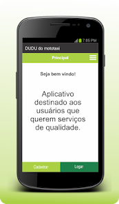
MOTOJÁ - Cliente
MOTOJ Cliente Aplicativo para pessoas e empresas que precisam do servio de motoboy
- 평점
- 평점 0
- 무료
139
자세히보기
![]()
AOS
지도/내비게이션

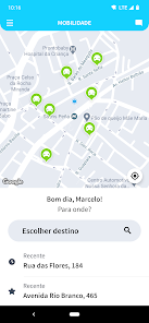
Яндекс Go: Такси Еда Доставка
Go
ULTIMA GO
Business Premier Elite Cruise
15
Go
Go
Go
16 000 18
Ultima
/
Ultima
- 평점
- 평점 4.9
- 무료
17,112,608
자세히보기
![]()

AOS
지도/내비게이션
5,687,048
자세히보기
![]()
공지사항
- 소프트쉐어 신규 소프트웨어 추가 안내 2025.01.17
- 소프트쉐어 서비스 이용 가이드 업데이트 안내 2025.01.17
- 소프트쉐어 웹사이트 리뉴얼 안내 2025.01.17