


 다운로드 TOP50
 PC 카테고리
 자유게시판
자유게시판
2GIS: Offline map & navigation
 다운로드수 131,109,501
-
4.8 (0명)


| 분류 | 지도/내비게이션 |
|---|---|
| 버전 | 없음 |
| 연령 | 3세 이상 |
| 업데이트 | 2011. 3. 9. |
| 금주 다운수 | 0 |
| 누적 다운수 | 131,109,501 |
| 개발사 | 2GIS |
| 다운로드 | |
|
!소프트웨어 사용범위 위반 시
법적 책임을 질 수 있습니다. |
|


상세정보
2GIS is a detailed map with GPSnavigation for car drivers and pedestrians live traffic map transit schedules and a full city directory Use it online or download the map to your device to never get lost without an internet connection
With 2GISs maps and navigation you will feel at home even in an unfamiliar place
easily find the address company phone number working hours goods or services
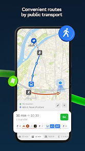
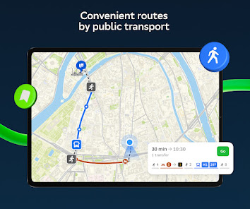
find out how to get there by car bus subway or follow the navigator on foot
find an entrance to a building and a parking lot nearby
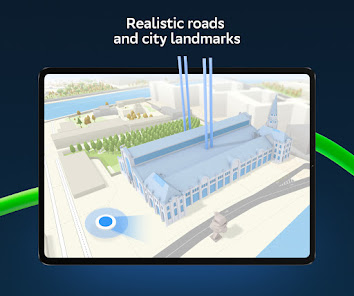
Accurate maps Locate districts buildings streets bus stops subway stations gas stations sports grounds and other objects
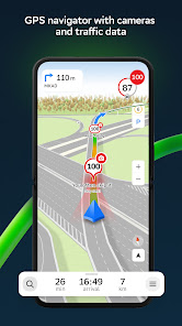
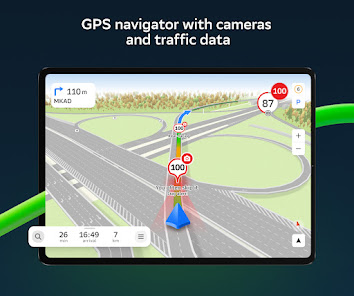
GPSnavigation Considers realtime traffic jams signs speed cameras toll and unpaved roads builds routes between cities and through several points There is also a free app for Android Auto
Road events Reports of accidents blocked streets and speed cameras user comments everything is right on the map
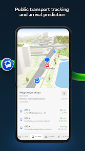
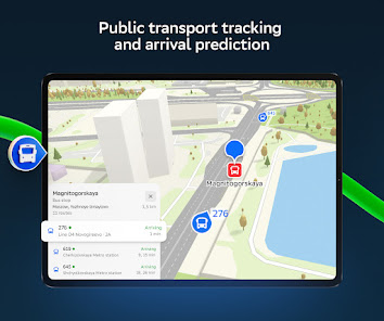
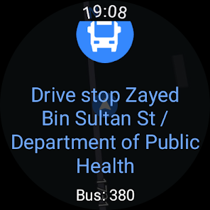
Public transport 2GIS knows the timetable and online routes of public transit
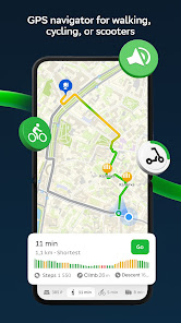
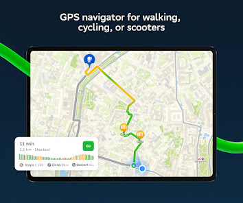
Walking routes Pedestrian navigation paves the way wherever you can go on foot Works in the background supports voice guidance
Navigation for trucks Cargo navigator gets directions for trucks considering the individual characteristics of vehicles and cargo
Friends on the map Now you can find your friends and kids on the map 2GIS shows the realtime location of your friends You decide who to add as friends and who will see your location Manage your visibility in the settings
Detailed directory 2GIS shows addresses entrances and postal codes 2GIS knows phone numbers working hours social networks websites and entrance locations Users add photos of companies and write reviews
Travel guide Find out about the main attractions places with WiFi and more on the map
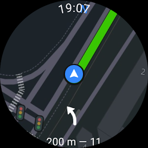
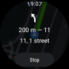
A 2GIS Notifications companion app for smart watches on Wear OS A handy tool for navigating routes on foot by bike or by public transport from the main 2GIS app view the map get manoeuver hints and get vibration alerts when approaching a turn or a destination bus stop The companion starts automatically when you start navigation on your phone Available for Wear OS 30 or later versions
Everything you need offline map navigation public transport family locator and Android Auto support all in 2GIS
Available maps
Cities of the UAE
Dubai Sharjah Abu Dhabi Al Ain Ajam Ras Al Khaimah Fujairah Umm Al Quwain Dibba Al Fujairah Khor Fakkan Kalba Al Salamh ect
Cities of Russia
Moscow Saint Petersburg Novosibirsk Ekaterinburg Krasnoyarsk Chelyabinsk Ufa Omsk Kazan Perm Nizhny Novgorod Sheregesh etc
Cities of Belarus Kazakhstan Uzbekistan Azerbaijan and Kyrgyzstan
Minsk Pavlodar Semey Aktau Aktobe Almaty NurSultan Bishkek Karaganda Kokshetau Kostanay Osh Baku Tashkent etc
Support dev2giscom
리뷰
- 소프트쉐어 신규 소프트웨어 추가 안내 2025.01.17
- 소프트쉐어 서비스 이용 가이드 업데이트 안내 2025.01.17
- 소프트쉐어 웹사이트 리뉴얼 안내 2025.01.17


